WELCOME TO THE BOG BLOG
WELCOME TO THE BOG BLOG
Lore’s blog about adventures in northern british columbia, 2022 - ?


Grassy Bay Alternate Route & Diana Lake Provincial Park
Classic bog route and a raging waterfall

The broken boardwalk across the bog to grassy bay. This boardwalk was made in the 1980s.
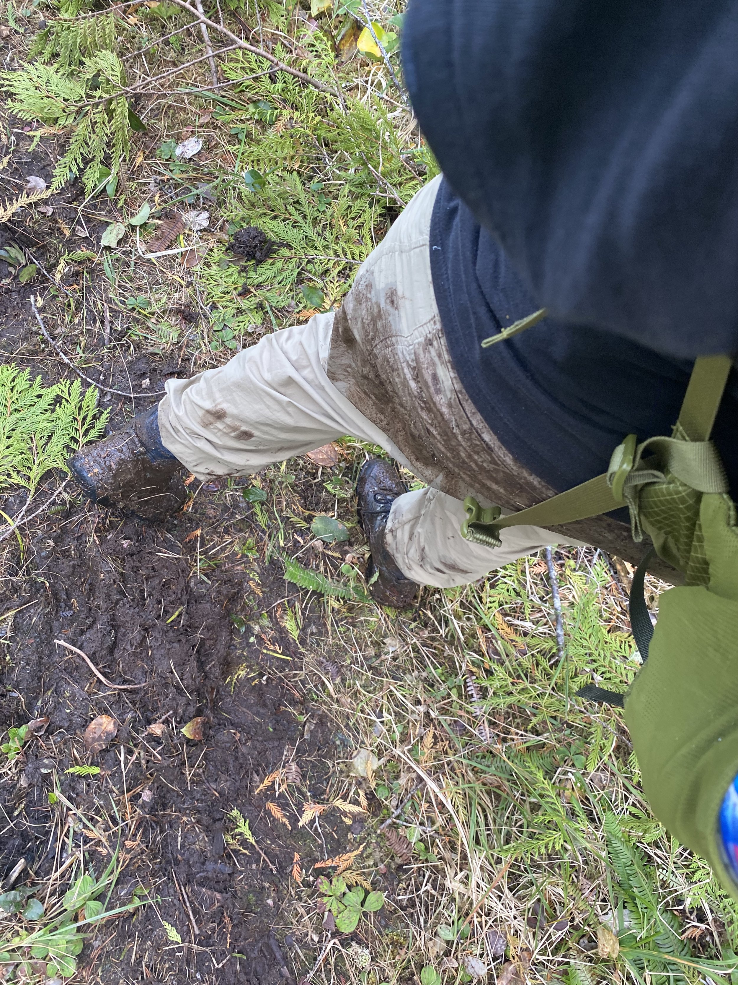
It was 22C and humid this weekend. Since I have a strong sense of guilt about wasting nice days, I knew I was going to do a hike. Having had Covid a few weeks ago, I’m still re-building my hiking capacity. So I did an unfamiliar route to a familiar place, Grassy Bay. Grassy Bay via the Butze Rapids trail is my favorite hike in the Prince Rupert area. The alternate route which leaves from the Shoe Tree I discovered thanks to The Outsider’s Guide to Prince Rupert. It’s marked as moderate, 1km each way. I really do not recommend this hike: see the image above. The entire way is really treacherous. I wore waterproof hiking boots, and managed to overtop them on this trail. I ended up completely focusing on where I was putting my feet, which was less than enjoyable. It took about 30 min each way. Take the Butze Rapids trail to Grassy Bay instead!

Safer part of the trail - where the boardwalk was completely covered by vegetation and therefore less slippery.

Most dangerous part of the trail - where the rotten boards crossed a river.
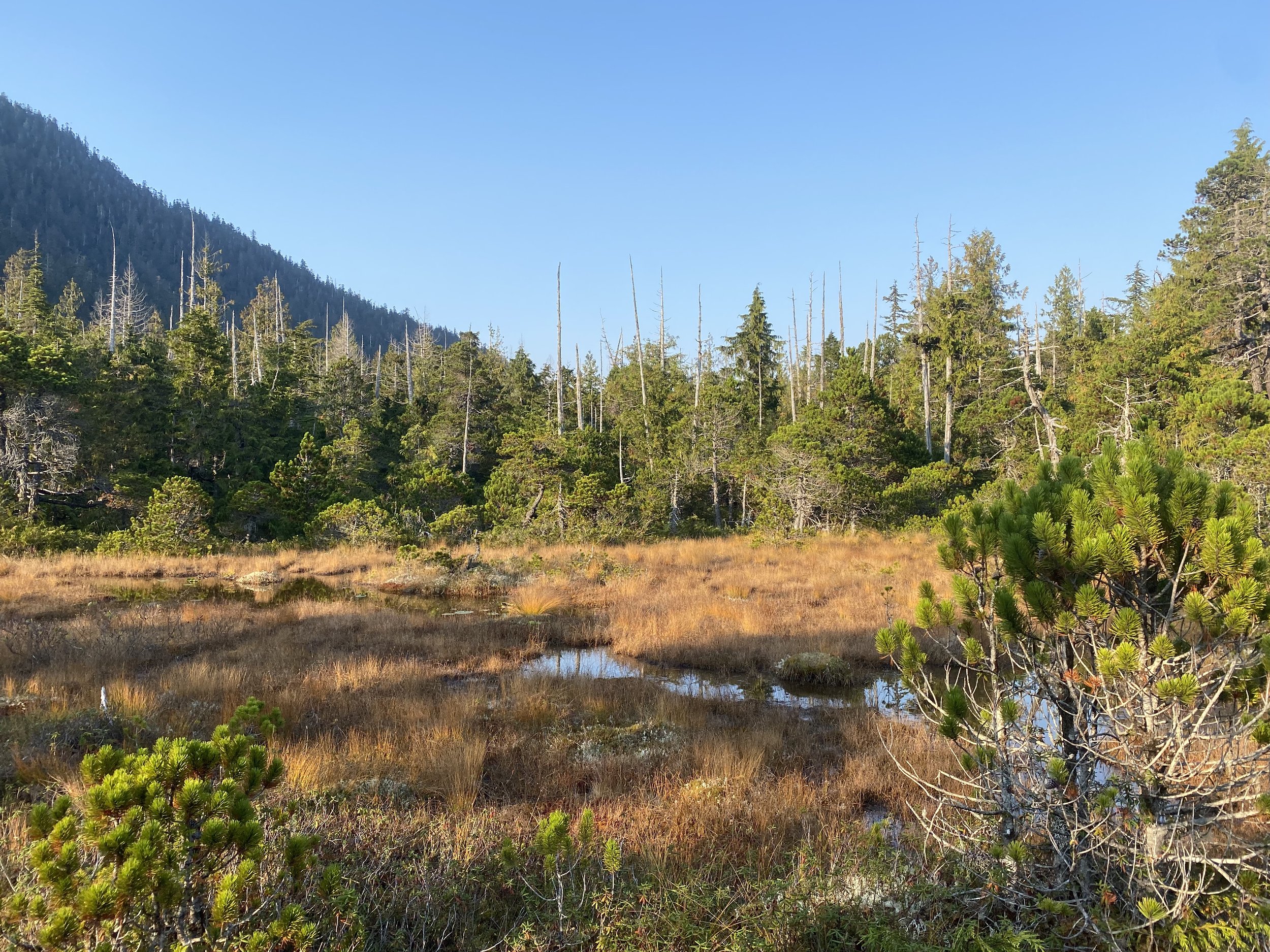
The bog proper. Sunny and warm.

Bog banana slug with nice coloring.
After the Grassy Bay hike, I still had energy and light left. I decided to go to Diana Lake Provincial Park, which is off the island. I drove there, dodging potholes with skill honed from years of Michigan driving, and parked at the lake. It was chockablock with logs, maybe not the best swimming experience. I explored a bit, and went down the Diana Creek path until I found the waterfall. It was raging, with tons of white foam at the foot of the falls. While standing right at the foot and filming, I managed to capture a small salmon jumping up the falls. Next I would also like to explore the unmarked hike that leaves from across the river picnic area and goes up the ridge, The Outsider’s Guide to Prince Rupert calls this route “McDonald”.

The massive foam field at the base of Diana Lake falls.

Shroom tree near the falls.

First Creek, Seal Cove
Grand tree forts and the Great Mushroom Tree
I went to First Creek Trail three times in short succession in early October. I discovered the trail by accident and intuition, on the dead end of Seal Cove Road. The first time I checked it out was wearing trail runners, I didn’t get very far. The next time I came back for real with hiking boots, and did most of the main trail. The last time I came with boots, gaiters, and two hiking poles and completed 2/3 of the alternate coastal trail. I was still recovering from Covid, so I plodded along at a really slow pace. The trail conditions on the alternate coastal trail were quite rough, inlcuding major bogginess, tree root climbing, brambles, low-tide briney river crossing, knee-deep muck, rusted steel cables, barbed wire, and missing trail markers. I would only recommend the alternate route for people who are already familiar with Prince Rupert hiking conditions. The main trail is OK enough for newbies, though it’s kind of spooky. This trail and the alternate route are detailed in The Outsider’s Guide to Prince Rupert.

Crazy tree fort. I swung on the swing, but otherwise didn’t trust the structure. This is right near the main trailhead.

The main trail looks to be 30+ years old based on the signage getting swallowed by the cedars.

Either you get a million different flags, or none…

The beginning of the main trail has old boardwalks. I recommend hiking shoes and hiking sticks.

Nice open forest on the main trail. You can hear the eagles calling from the nearby wildlife rehabilitation centre.

Tranquil mushroom tableau on the main trail.

In the sunlight like dustmotes you can see water droplets.

The alternate coastal trail rewards you with these views.

The Great Mushroom Tree. I turned around after discovering it - the coastal alternate route trail after this was not well-marked.

Gitxaała Nation: The Hill
A dog and a bog
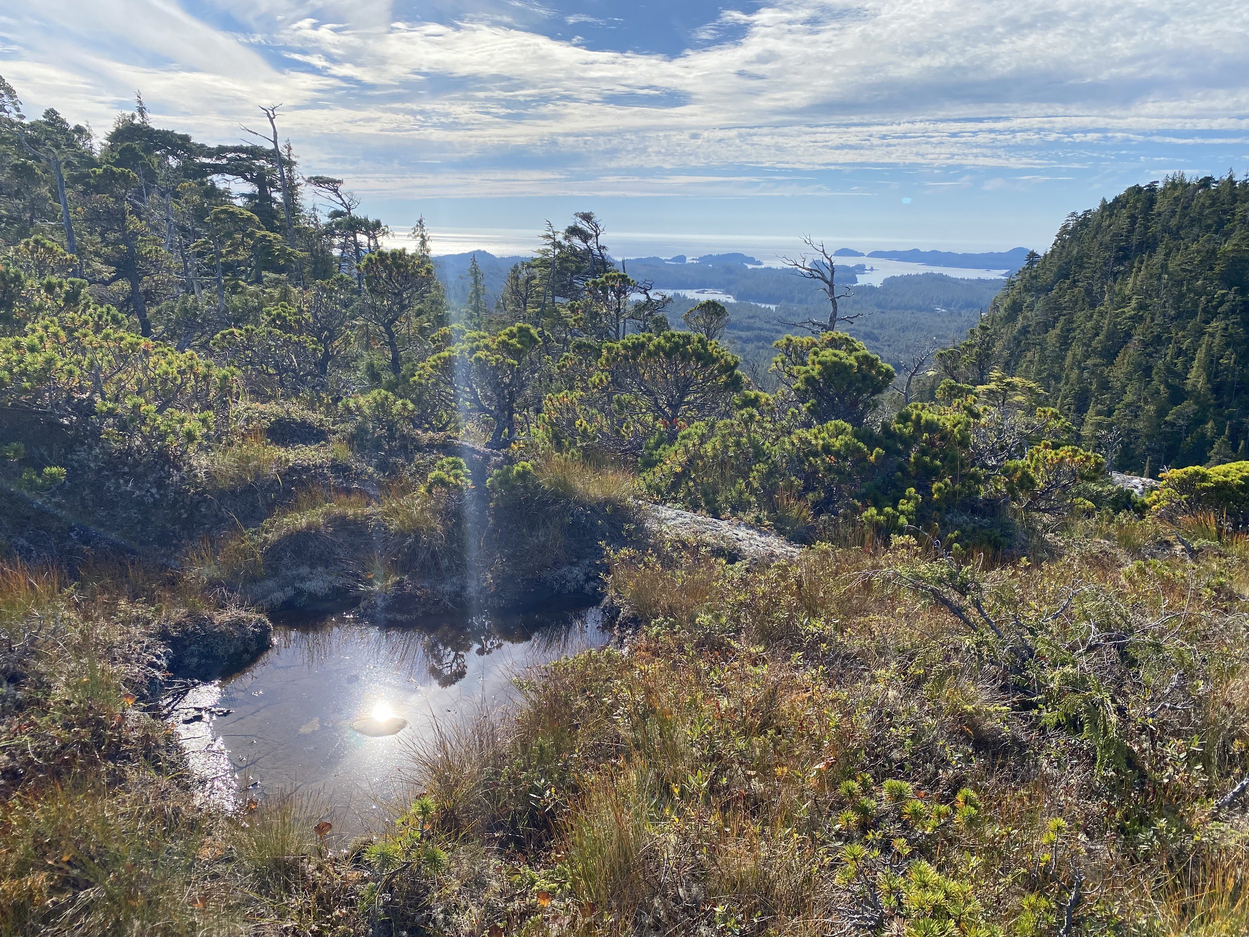
I have taken two trips now to Gitxaała Nation HQ, Kitkatla, Dolphin Island. The first time I took a single-engine plane and only stayed for a few days. The next time I came on the ferry, which only comes twice a week, and stayed a lot longer. When I asked about hiking, people told me about the one maintained trail on the island, The Hill. So on a warm sunny day in September, I set off (first I told my co-worker where I was going and when to expect me back, safety first). A very personable dog named Apollo spontaneously decided to follow me, and continued to follow me the entire hike. It was extremely steep, very wet, and quite slippery. It had not rained in a week, but it was still super soggy! I highly recommend this hike for the beautiful views. Once up top the hill, you can traipse around a bit in the bog highlands. Bring binoculars, as you can see all the way to Haida Gwaii on a clear day.

The Tsimshian Storm ferry boat to Kitkatla.

On the way you pass the Port of Prince Rupert.

The start of the trail up The Hill - not too bad! It looks muddy, but there’s no dirt. It’s all plants. So your boots stay clean!

Classic bog close-up. If anyone knows what this vegetation is called, please comment below :)

The blue rope up the hill. It only takes 30 minutes to get up, but it feels like a lot longer!! You can see the pupperino who accompanied me at the top - I wish I was a quadruped.
Warm pools of water on top of the hill. With my binoculars, I could look west all the way to Haida Gwaii. The dog loved to roll around in these pools.

Looking down on the village of Kitkatla.

Apollo the dog spontaneously decided to accompany me up the hill. It made me want to get a hiking dog.

Requisite bog selife
I acquired lived experience about bogs on this trip. Bogs are cold, even when it is warm and sunny.

Nisga'a Memorial Lava Bed Provincial Park
Seafood, sunshine, and suspension bridge
I visited the Nisga'a Memorial Lava Bed Provincial Park twice, with my parents in August and with my partner Keith in September. Both times were absolutely beautiful - the weather is drier and sunnier a few hours inland compared to Prince Rupert. The park is located about an hour north of Terrace. Prepare for winding roads and distracting mountains.
There is both world-class nature and culture: unique geologic features and an amazing museum and visitor centre. I learned a lot about Nisga’a Nation’s culture and history. The park is the site of Canada’s most recent volcanic activity: around 1700, an eruption beset the valley and killed 2,000 Nisga’a people. The lava beds are 12 meters deep.
We did the Auto Tour, driving around to see lava tree moulds, hiked the pahoehoe lava, picnicked at the lava-dammed lake, dipped in the hot spring, and visited the four villages in the valley. I learned the most on a hike to the volcano cone with tour guide Steve.

Lava waterfall on one of the Auto Tour stops.

Mom in front of the entrance to the cultural centre. A really nice guy works there, he showed us informative short documentaries about Oolichan fishing and the lava disaster.

Father examining something on the pahoehoe lava.

Lava Lake. The waters of the lava-proximal waters were always light blue, similar to glacial lakes. I was not sure if this was due to loess sources or because the lava had very fine particles that were coloring the water.

Oscar Peak, the most impressive peak in the entire area. Below is the blue water of Lava Lake. This is right at the entrance to the park. You can swim, but the water is cold and the lava is sharp. Mom swam out to the rock in the foreground.

Hlgu Isgwit hot springs. We are smiling but dying inside. There was an astronomical amount of mosquitos. You have to reserve your 1-hour visit a day in advance and pay cash money at the government office to go here.

Suspension bridge in Gitwinksihlkw (Place of the Lizards).

My parents and I drove all the way down to the furthest village, Gingolx (Place of Scalps), near the mouth of the Nass River. There was a very nice lady who ran a seafood restaurant - I called ahead and she made us delicious salads.

The Nisga’a Museum - world class!

Keith examining some lichen on the lava. In the foreground is light green reindeer lichen, it is crunchy and grows very fast.

Keith and Val on the hike to the cinder cone. The lava makes beautiful rivers and waterfalls.

Val on the hike to the cinder cone.

It’s hot out on the lava beds. This oasis was very tempting.

Val and Keith on the edge of the cinder cone. It’s deeper than it looks. Thanks to Steve for taking this picture!

Butze Rapids
Easy way to experience a bog and the rainforest
If you are only going to do one hike in Prince Rupert, I would say do this one. Butze Rapids is a well-maintained trail through coastal rainforest and bog, and is one of the best ways to access the water on Kaien Island. It’s a popular trail, but not suffocatingly busy. You only need tennis shoes. It comes out on Grassy Bay, a beautiful bay overlooking some mountains/hills, and the reversing rapids in Fern Passage, which roar with white water when the tide switches direction.

Rainbow over Grassy Bay.
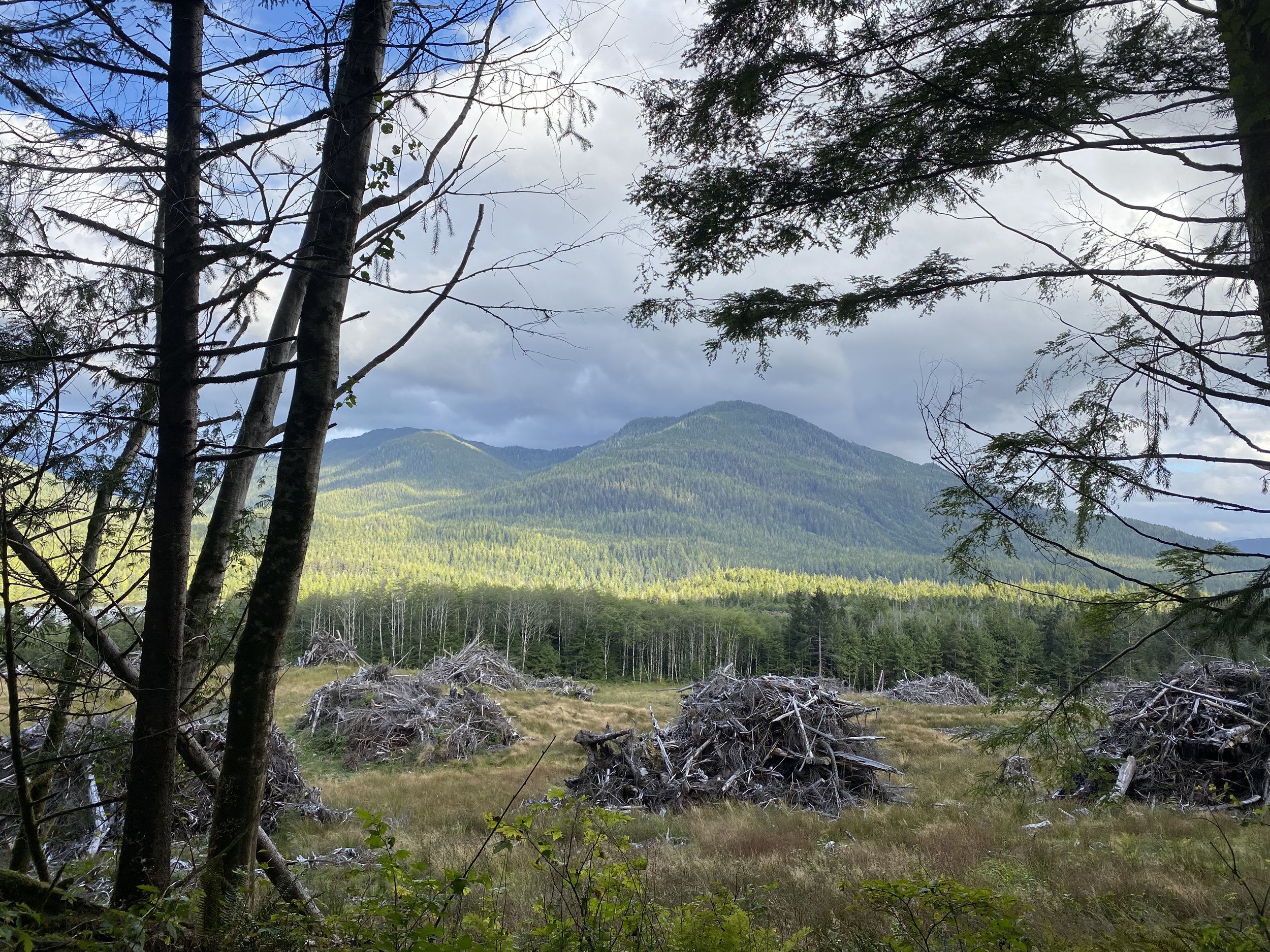
Strange and beautiful scene as you enter the trail, large piles of wood near the Prince Rupert Industrial Park.

A rainforest pool.

Inviting!

Home Base
Reverberating rainbows
I moved to Prince Rupert, British Columbia, on July 30th, 2022. I flew, and my parents drove here with my two rats a few weeks later, leaving me the car, Rupie. I have a little 1940s house to myself, an overgrown garden, and nice neighbors. So far, so good!

Flying over northern BC on my way to Prince Rupert. Surprisingly, no issues with the cross-country flights.

Arriving on the ferry from the airport. The airport is on an island for some reason.
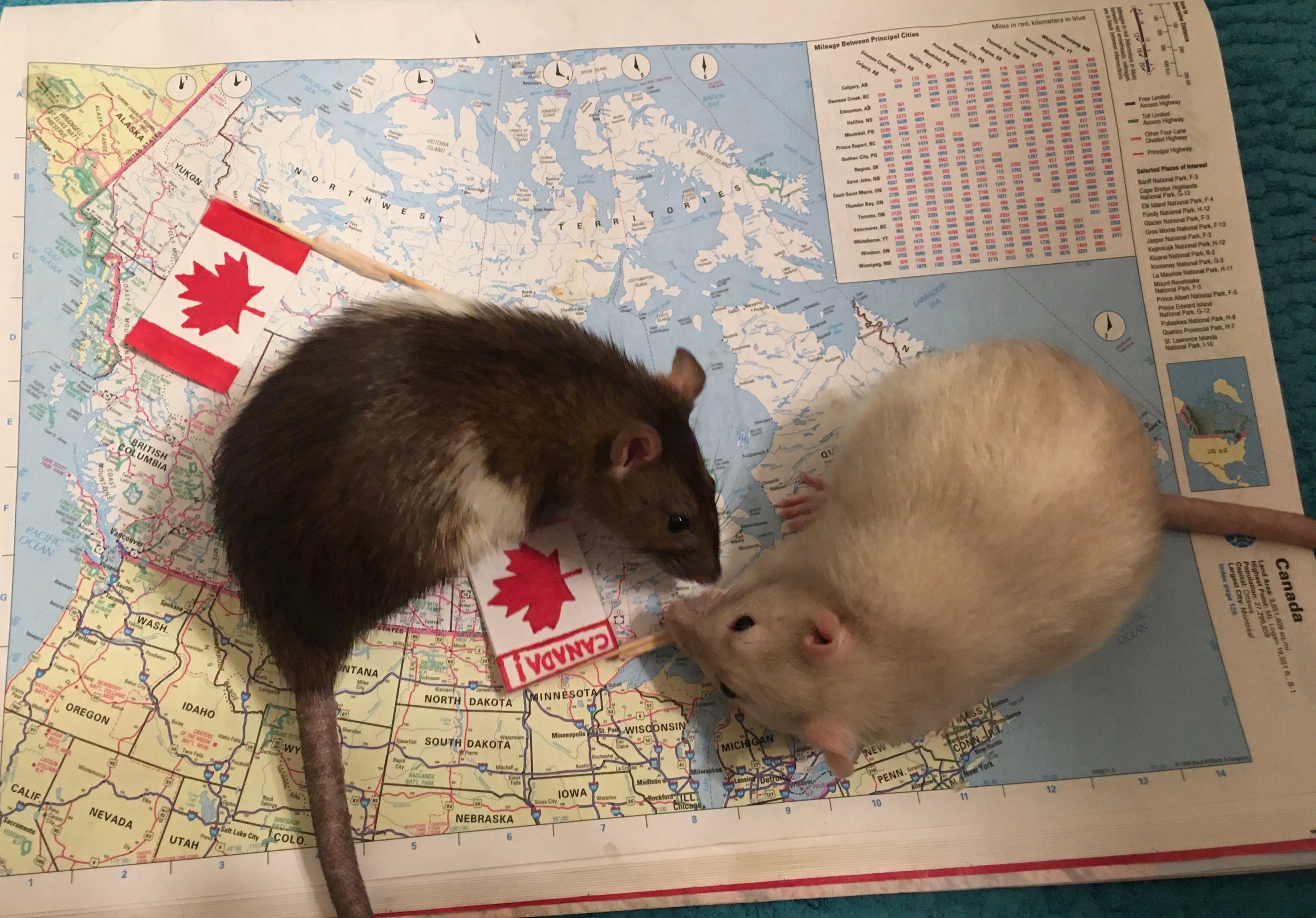
Juniper (left) and Rodinia (right) made the journey with my parents across the continent to be with me.

Mom and dad on the urban ravine trail system in front of an old-growth cedar.

My favorite snack spot - unfortunately it closes seasonally at the end of August. I get the sweet potato fries. Crows will sidle up and try to get a bite. It’s right at the trailhead of the well-maintained waterfront Rushbrook Trail.

This is not pee. The water is naturally terrible. It’s yellow, tastes bad, the city has frequent boil alerts, and lots of the pipes in town are lead - and the water is soft so the lead enters the water.

Bucks like to sleep and fight in my backyard.

A cliffside hangout near my house. You have to go down a minor cliff to get here. When I first arrived it was covered in trash unfortunately. I picked it up but it seems to be a stoner hang out so the trash keeps accumulating.

A reverberating mulitbow.

Bought The Outsider’s Guide to Prince Rupert, 2nd Edition by Matt J. Simmons as soon as I moved here. It is a guide to all the hikes in the area. Don’t necessarily trust the difficulty ratings.